Please complete the form below

Ishinomaki is a city on Japan’s Honshu mainland. Housed in a striking spaceship-shaped building, the Mangattan Museum is dedicated to the work of manga artist Shotaro Ishinomori. Along the coast, San Juan Bautista is a replica of a 17th-century Japanese galleon. Offshore, Kinkasan Island is home to wild deer and the 8th-century Koganeyama-jinja Shrine. Trails lead to the island’s summit for panoramic city views.
Miyako Island is 300 km south of Okinawa island, and is famous for its beaches, said to be Japan’s most beautiful. Maehama beach is for swimmers, while Yoshino has great coral reefs for snorkelers and the white-sand Sunayama has dramatic rock formations. Cape Higashi-Hennazaki is a long, narrow cape with the picturesque lighthouse at the end. The city’s Botanical Garden boasts over 1600 tropical varieties. Nakasone Tuyumya was an important leader of Miyako and the Okinawan people in the 16th century. Near the port in Hirara is memorial to him and his descendants, a designated national cultural asset. At the island’s north end, the graceful Ikema Ohashi bridge leads to the small Ikema Island.
This important port on Japan’s northern Hokkaido Island was the first to be opened to European and American trade. The result of this is a trove of Western-style buildings in the suburb of Motomachi that gives the impression of a movie set. The bell of the distinctive Haristo Greek Orthodox church is designated one of Japan’s official treasured “100 soundscapes.” Hokkaido is famous for its hot springs, much beloved by the Japanese. Yunokawa Hot Spring enjoys a commanding view of the sea, and its botanical garden is home to the Japanese macaques called “snow monkeys” because of their habit of soaking in the hot springs during the northern winter. Goryokaku is a 150-year old star fortress that holds the Magistrate’s Office, an excellent example of traditional Japanese architecture. Get a panoramic view from the observation platform atop the Goryokaku Tower.
Blessed by a protective range of mountains and a relatively warm ocean current, Kushiro gets less than a third of the winter snow of its Hokkaido neighbor Sapporo, and twice as much sunshine as the nearby Kuril Islands. Thus it is an important reliably ice-free port during the winter. Like all of Japan, it is riddled with semi-active geothermal features and occasionally rattled by tremors. Scenic Lake Akan is ringed by hot springs. It also has an Ainu Koten museum with a replica village and folklore performances of the indigenous Hokkaido people. The Japanese Crane Reserve is a good place to see breeding populations of these large and graceful birds, so respected by the Japanese. The city encompasses Japan’s largest wetland, and the Kushiro City Marsh Observatory has a boardwalk to see it, as well as the Fureai Horse Park which offers equestrian tours into the forest.
The largest of the Aleutian Islands, Kodiak is also Alaska’s largest island the second largest in the United States. Although occupied by native people for some 7,000 years, it languished in relative obscurity until the Second World War, when it housed as many as 25,000 troops. Fort Abercrombie, once the major center of North Pacific operations, today is a State Historic Park and a good place to learn the history. At the other end of the road system is the United States Coast Guard’s largest base, with a fleet of orange and white watercraft and aircraft that serves the Alaskan fishing fleet and other shipping and maritime activities in the Pacific area. Kodiak harbor is seasonally home to a fleet of some 650 fishing vessels, including huge trawlers, long-line and crab boats. Fishing is also a popular draw for visitors, but they also are attracted by opportunities to view and photograph local birds and wildlife, including the island’s massive brown bears, the males of which weigh as much as 1,500 pounds and stand ten feet tall. In the town, the fur warehouse originally built by the Russian American Company in 1808 is now the Baranov Museum, the oldest standing building in Alaska.
VIEW CRUISES
Designated as an International World Heritage Site in 1992, Glacier Bay is also a National Monument, a National Park and a designated Biosphere Reserve. Over millennia, Glacier Bay has experienced many major advances of its glaciers. When first surveyed in 1794 by a team under the command of British captain George Vancouver on HMS Discovery, its vast glaciers extended well beyond present-day margins of the bay.
Temperate, coniferous rainforest dominates its southern shores. Black and brown bears, wolves, moose, eagles and ravens all go about their daily routines, while harbor seals and whales frolic within the bay waters.
Glacier Bay has two major arms, East and West, and over fifty named glaciers, some of which push forward at three to six feet per day. Combined with Wrangell St. Elias National Park and Canada’s Kluane National Park and Alsek-Tatshenshini Park, Glacier Bay encompasses the largest protected wilderness area on earth. This is a truly a place of awe-inspiring beauty and an icon of wild Alaska.
VIEW CRUISES
Skip Footer Content
About Us
A stroll through the streets and National Historic Park of Sitka is a glimpse into its unique and colorful past. A blend of Tlingit and Russian cultures defines this first capital of Alaska. Although fish canning and gold mining were the initial catalysts for growth in Sitka, the construction of an air base during World War II truly paved the way for Sitka to come into its own. One of Sitka’s most intriguing structures is the Cathedral of Saint Michael, built in 1848 to honor a Russian Orthodox bishop.
Sitka’s history begins thousands of years ago with the Tlingit people and their use of the land for sustenance and spirituality. Old Sitka, located just north of the present-day settlement, was founded by Russian-American Company trader Alexander Baranov in 1799. Originally named Novo-Arkhangelsk (New Archangel) under Russian rule, its name was changed to Sitka after Alaska was purchased by the United States in 1867. Sitka is a Tlingit word meaning ‘by the sea.’
Prince Rupert, set amongst the coastal mountains, is the jumping-off point for travelers joining the coastal ferries to Haida Gwaii, Vancouver or north to Alaska. Highlights include the quaint Cow Bay with its shops and restaurants, the Museum of Northern British Columbia, the totem carving house or the stunning sunken gardens.
Prince Rupert certainly has abundant wildlife. Whether you join a local boat for whale-watching, hike along the Butze Rapids or take a scenic flight, you are sure to be pleased. The region is home to the highest concentration of grizzly bears in North America. The Khutzeymateen Grizzly Bear Sanctuary, established in 1994, was the first area in Canada to be protected specifically for grizzlies and their habitat.
Founded in 1910, the town was named for Prince Rupert, who was a governor of the Hudson’s Bay Company in 1670. Prince Rupert is the northern terminus of the Canadian National Railway and an important port for goods moving towards Alaska.
VIEW CRUISES
Grenville Channel is a long, well-protected channel along the northern British Columbia coast between the large Pitt Island and the mainland. It is an important shipping lane, and you are likely to see ships of many different types and sizes as you pass through. The shores are mountainous on both sides, with two notable peaks about halfway through, Mt. Batchellor on the east side and Mt. Saunders on Pitt Island to the west. There are a number of Indian Reserves and Marine Parks in the mountains and narrow waterways off the channel.
The Princess Royal Channel separates the largest island along British Columbia’s coast from the mainland. It is located roughly halfway between Bella Bella in the south and Prince Rupert in the north, in one of the province’s most remote areas. Princess Royal island was named in 1788 by Captain Charles Duncan, in honor of his ship, the Princess Royal. The island is uninhabited, although there are two small villages in the channel, the First Nations community of Klemtu on Swindle Island and Hartley Bay on the mainland. Wildlife, by contrast, is plentiful, including Kermode, black and grizzly bears, deer, wolves and foxes. Golden and bald eagles nest in the region, as well as the endangered marbled murrelet. In the waters, there are abundant salmon, elephant seals, whales, orcas and dolphins.
Johnstone Strait is a well-protected shipping route passing 68 miles/110 km along the northeast shore of Vancouver Island between the island and the mainland of British Columbia. The strait is between 1 ½ miles and 3 miles wide, and leads from the broad Georgia Strait through a narrow channel called Discovery Passage. The strait was named by Vancouver in 1792 for James Johnstone, the master of one of his tenders during the survey expedition that revealed Vancouver Island to be an island. There are no cities or towns on the strait. The Johnstone Strait is the summer range of a large pod of seasonally resident orcas which are frequently seen in the area. VIEW CRUISES Skip Footer Content About Us Our Company News Careers Contact Us Video Gallery Accessibility Seabourn Club Seabourn Referral Program Travel Resources
The Seymour Narrows is a 3-mile/5 km stretch of the Discovery Channel north of Vancouver Island, British Columbia that is notorious for the strength of the tidal currents flowing through it. The average width of the narrows is just 750 meters. During extreme tides, the current through the narrows is subject to severe Venturi effect, resulting in an increased velocity that can reach 15 knots. For much of its modern history, there was an additional hazard in the narrows called Ripple Rock, a shallow obstruction that claimed no fewer than 119 ships and 114 lives. In 1958, after months of tunneling and preparation, Ripple Rock was blown up in the largest commercial, non-nuclear explosion ever recorded in North America. Still, the navigation of Seymour Narrows is dependent on tidal and other conditions, and requires skill and technical accomplishment.
The humble beginnings of the City of Vancouver, in the settlement of Gastown on Burrard Inlet, rose out of the old growth forests and the sawdust of the old Hastings Mill. Its location between the Pacific Ocean and the snow-capped coastal mountains creates one of the most idyllic settings of any city in the world. As a world-class city it has the best of both worlds, intermingling urban sophistication with a sense of wilderness and outdoor adventure. Whether you are exploring Vancouver’s diverse downtown core, strolling through the giant trees of Stanley Park or taking in the 20 miles (30 km) of uninterrupted waterfront trails along the seawall, you are bound to fall in love with Canada’s third largest metropolitan center, which is consistently ranked as one of most livable cities on earth.
In 1886, the Canadian Pacific Railway reached Vancouver, completing Canada’s ‘National Dream’ of a connection between east and west, and opening up new trade routes between Asia and Europe. The city was named for British captain and explorer George Vancouver.
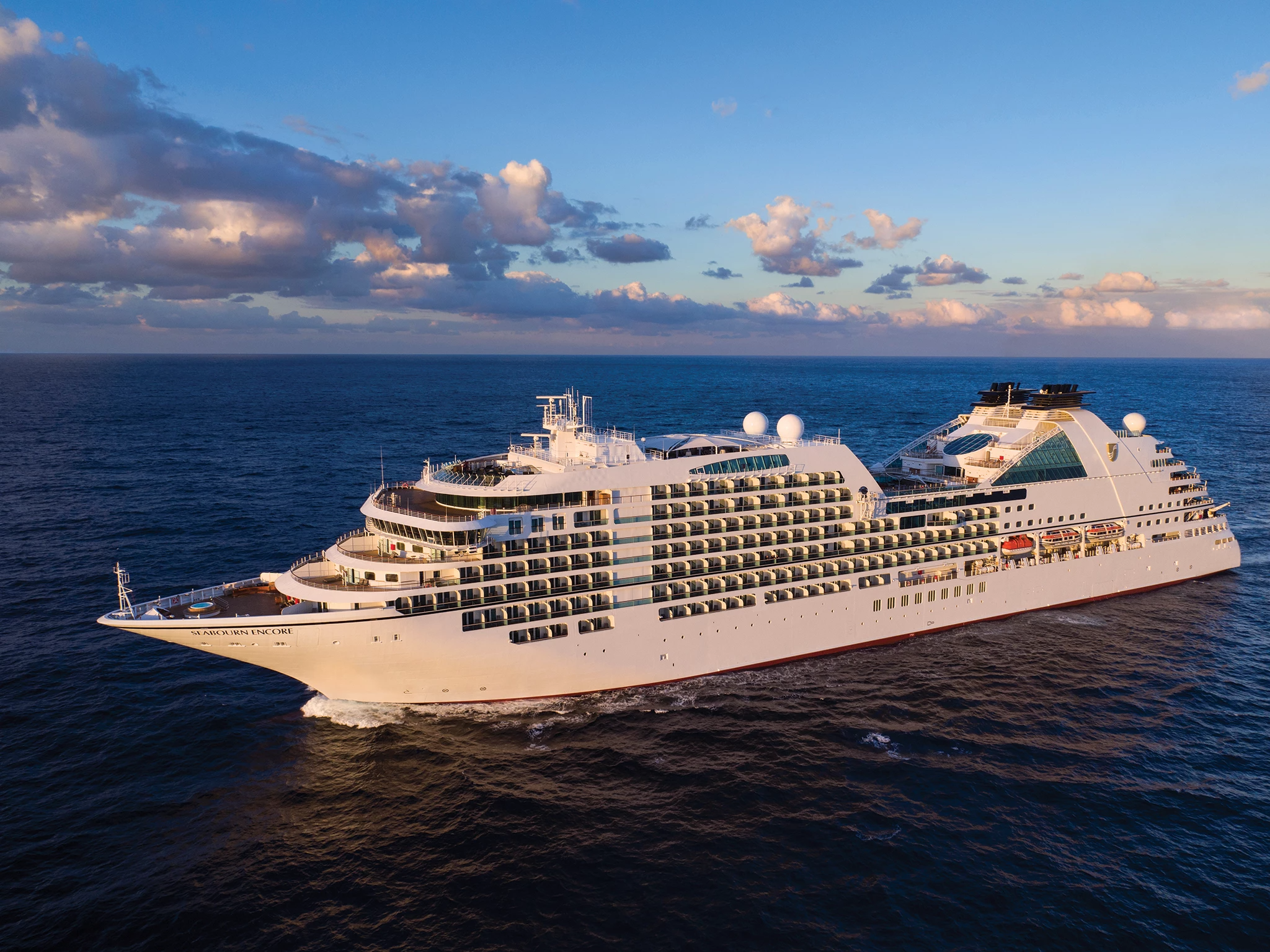
Seabourn Encore is as strikingly beautiful and as excitingly innovative as any Seabourn has ever debuted. She crowns a fleet of luxury cruise ships that is already the newest, most modern and most acclaimed in the ultra-luxury segment. Modeled on the award-winning trio of ships introduced with Seabourn Odyssey, Seabourn Encore represents another welcome stage in the evolution of small ship cruising, which Seabourn pioneered and has consistently expanded and enriched for all of our small ship cruises.
Couples Treatment Room
Spa
Sun Terrace
Swimming Pool
The Retreat
Whirlpool
Bar
Coffee Bar
Restaurant
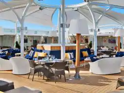
Sky Bar
Sushi Bar
The Colonnade
Casino
Gaming Club Casino
Photo Gallery
Theatre
Internet Cafe
Conference Room
Elevator
Medical Centre
Shops
Fitness Center
Gym
Wellness Centre
Card Room
Library
Please complete the form below