Please complete the form below

The humble beginnings of the City of Vancouver, in the settlement of Gastown on Burrard Inlet, rose out of the old growth forests and the sawdust of the old Hastings Mill. Its location between the Pacific Ocean and the snow-capped coastal mountains creates one of the most idyllic settings of any city in the world. As a world-class city it has the best of both worlds, intermingling urban sophistication with a sense of wilderness and outdoor adventure. Whether you are exploring Vancouver’s diverse downtown core, strolling through the giant trees of Stanley Park or taking in the 20 miles (30 km) of uninterrupted waterfront trails along the seawall, you are bound to fall in love with Canada’s third largest metropolitan center, which is consistently ranked as one of most livable cities on earth.
In 1886, the Canadian Pacific Railway reached Vancouver, completing Canada’s ‘National Dream’ of a connection between east and west, and opening up new trade routes between Asia and Europe. The city was named for British captain and explorer George Vancouver.
The Seymour Narrows is a 3-mile/5 km stretch of the Discovery Channel north of Vancouver Island, British Columbia that is notorious for the strength of the tidal currents flowing through it. The average width of the narrows is just 750 meters. During extreme tides, the current through the narrows is subject to severe Venturi effect, resulting in an increased velocity that can reach 15 knots. For much of its modern history, there was an additional hazard in the narrows called Ripple Rock, a shallow obstruction that claimed no fewer than 119 ships and 114 lives. In 1958, after months of tunneling and preparation, Ripple Rock was blown up in the largest commercial, non-nuclear explosion ever recorded in North America. Still, the navigation of Seymour Narrows is dependent on tidal and other conditions, and requires skill and technical accomplishment.
The Queen Charlotte Sound lies between the Queen Charlotte Strait, which winds between Vancouver Island and the British Columbia mainland in the south, and Hecate Strait, which is northward, adjacent to the Haida Gwaii Islands off the Pacific coast of British Columbia. It is a broad reach in the long shipping route called the Inside Passage threading the myriad islands stretching from Washington’s Puget Sound to Alaska.
Ketchikan is a picturesque coastal town with a colorful frontier history, standing at the southern entrance to Alaska’s famed Inside Passage. It began as a salmon cannery in 1885, built by company employee Mike Martin at the mouth of Ketchikan Creek. Once dubbed the ‘Canned Salmon Capital of the World,’ today government, commercial fishing, and tourism are its main industries. The renowned Creek Street, perched on stilts along the mouth of the creek, would bring lasting infamy to the area for the red-light district that burgeoned there during the Gold Rush.
The town’s site first served as a camp for Tlingit people, and for thousands of years this has been their home. Their rich culture is being preserved to this day. A visit to Ketchikan is not complete without visiting one or all of Native American sites such as Totem Bight State Park, Potlatch Park, Saxman Native Village and the Totem Heritage Center. Together, these locations comprise the world’s largest collection of standing Native American totem poles.
VIEW CRUISES
In the passage between Sumner Strait and Clarence Strait in Southeast Alaska’s Alexander Archipelago, midway between Price of Wales Island on the west and Zarembo Island on the east, is a small cluster of islands with a picturesque passageway between them called Snow Pass. It makes a scenic up-close route for your Seabourn ship during the transit.
Decision Passage is the western end of the Sumner Strait, which runs through the Alexander Archipelago into the Pacific Ocean in Southeastern Alaska, bounded on the north by Kuiu Island and Cape Decision, the location of a 1932 lighthouse. This is the route your ship takes when coming from or going to the colorful historic community of Sitka on the west coast of Baranof Island, which was originally the Russian fortress town of New Archangel.
A stroll through the streets and National Historic Park of Sitka is a glimpse into its unique and colorful past. A blend of Tlingit and Russian cultures defines this first capital of Alaska. Although fish canning and gold mining were the initial catalysts for growth in Sitka, the construction of an air base during World War II truly paved the way for Sitka to come into its own. One of Sitka’s most intriguing structures is the Cathedral of Saint Michael, built in 1848 to honor a Russian Orthodox bishop.
Sitka’s history begins thousands of years ago with the Tlingit people and their use of the land for sustenance and spirituality. Old Sitka, located just north of the present-day settlement, was founded by Russian-American Company trader Alexander Baranov in 1799. Originally named Novo-Arkhangelsk (New Archangel) under Russian rule, its name was changed to Sitka after Alaska was purchased by the United States in 1867. Sitka is a Tlingit word meaning ‘by the sea.’
One of the straightest stretches of the Inside Passage is the Stephens Passage just south of Juneau, a 105-mile channel between 5,000-foot peaks that cuts through the Alexander Archipelago between Admiralty Island on the west and the mainland and Douglas Island on the east. It is a good place to be on deck, because Admiralty boasts more bears than people, and the spruce and hemlock forests come right down to the water. The Passage is generally considered some of the best whale-watching water in Alaska, and also holds plentiful populations of huge Steller sea lions, as well as flocks of gulls and guillemots that clatter aloft as the ship passes. The passage was named by George Vancouver in 1794 after being charted by Joseph Whidbey.
Tucked in along the shores of the longest fjord in North America and surrounded by breathtaking scenery, Haines is an authentic Alaskan experience. It is an eclectic community and a truly hidden gem. Its rich culture shines brightly during the annual state fair that draws people from all over Alaska.
Haines is home to the largest concentration of bald eagles on earth, and grizzly bears gorge themselves on spawning salmon in its rivers. It was originally named Dteshuh, which means ‘end of the trail’ in the language of the Chilkat natives, who used to portage across the peninsula to Chilkat Inlet as a shortcut to their trade route to the interior.
The first Europeans arrived in 1879 to build a school and a Presbyterian mission. In time, the mission was renamed Haines in honor of Francina E. Haines, the chairwoman of the committee that raised funds for its construction. Haines grew dramatically during the 1899 Klondike gold rush in the Yukon, supplying prospectors with food and equipment.
VIEW CRUISES
Lynn Canal is a 90-mile long inlet into Alaska’s coast running from the Chilkat River in the north to the Chatham Strait and Stephens Passage in the south. Because it connects the towns of Skagway and Haines to Juneau and the rest of the Inside Passage, it is an important shipping lane for ferries, cargo and cruise ships, and was a crucial passageway to the Klondike gold fields during the Gold Rush. It was discovered by Joseph Whidbey in 1794 and named by George Vancouver after his birthplace, King’s Lynn in Norfolk, England. More than 2,000 feet in depth, it is one of the deepest and longest fjords in the world, and the deepest in North America outside Greenland.
As the gatekeepers to the northern entrance of the fabled Inside Passage, the remote Inian Islands stand between Cross Sound and Icy Strait, exposed to the high energy seas of the Pacific Ocean. Tidal currents surging through the narrow channels separating the islands can be severe. Nicknames like ‘The Laundry Chute’ justify their notorious reputations.
For millennia, Tlingit people came here to hunt and fish in the rich bounty that these waters provided. Today, the Inian Islands Institute, located within the islands, provides access to the abundant and protected waters for scientific research. Sitka black-tailed deer and brown bears frequent their rugged and rocky shores, while sea lions fill their stomachs with salmon before hauling out to rest on the many rocky outcrops making up this island group. Sea otters, bald eagles, and humpback whales frequent the area in great numbers during the summer months.
The Inian Islands were named by William Healey Dall, one of Alaska’s earliest scientific explorers, in 1879.
The Hubbard Glacier is the largest, and one of the most spectacular tidewater glaciers in North America. Its ice cliffs, some 400’ (121 m) tall, calve icebergs into the fjord, which may frequently be larger than a five-story building. The glacier’s surface is creased and contorted, resembling the wrinkled skin of a giant elephant. Records show it has been growing in thickness and advancing since 1895. This stands in stark contrast to other glaciers around the world, most of which have been receding during the past century. In 2002, the glacier blocked Russell Fjord for two and a half months, raising water levels 61’ (18 m) and threatening local communities with flooding. Nutrient-rich waters along the glacier face attract many species. Gulls and kittiwake colonies adorn smaller islands and harbor seals patrol the icy waters. In 1890, Israel Russell explored the area of Yakutat Bay and Hubbard Glacier, naming it after Gardiner G. Hubbard, a financier of his expedition and a founder and the first president of the National Geographic Society. VIEW CRUISES
The Holgate glacier flows for three miles (5 km) through the rugged mountains of Kenai National Park. Its origin is in the 300 square miles (770 sq. km) of the Harding Icefield, the largest icefield contained entirely within the United States. The glacier transports huge boulders and debris on its surface, and as it reaches the ocean it becomes heavily crevassed. A day’s sail from the town of Seward, this tidewater glacier is a popular destination for those in search of a spectacular ice experience. Its calving events echo off the steep fjord walls like the sound of distant thunder, blanketing the surface of the surrounding waters with crystal-blue brash ice. Seals and seabirds are often seen searching among the floating ice for their next meal in the nutrient-rich waters. Holgate Glacier is named for Thomas F. Holgate, the Dean of the College of Liberal Arts of Northwestern University. It was named during a geological survey of Alaska conducted between 1908 and 1911.
Whittier was developed by the United States government as a strategic military port for the North Pacific during World War II. It is still an important ice-free, deep water port for Alaska’s largest city of Anchorage, approximately 58 miles away. Until 2000 it was connected only by rail through a tunnel blasted in the surrounding mountain range. Today the tunnel has been improved to allow regular road transport access from the Seward Highway. It is a useful terminal for rail and ferry traffic and cruise ships embarking and disembarking guests for Anchorage. Most of the town’s fewer than 300 residents live in two tall residential towers originally built by the military.
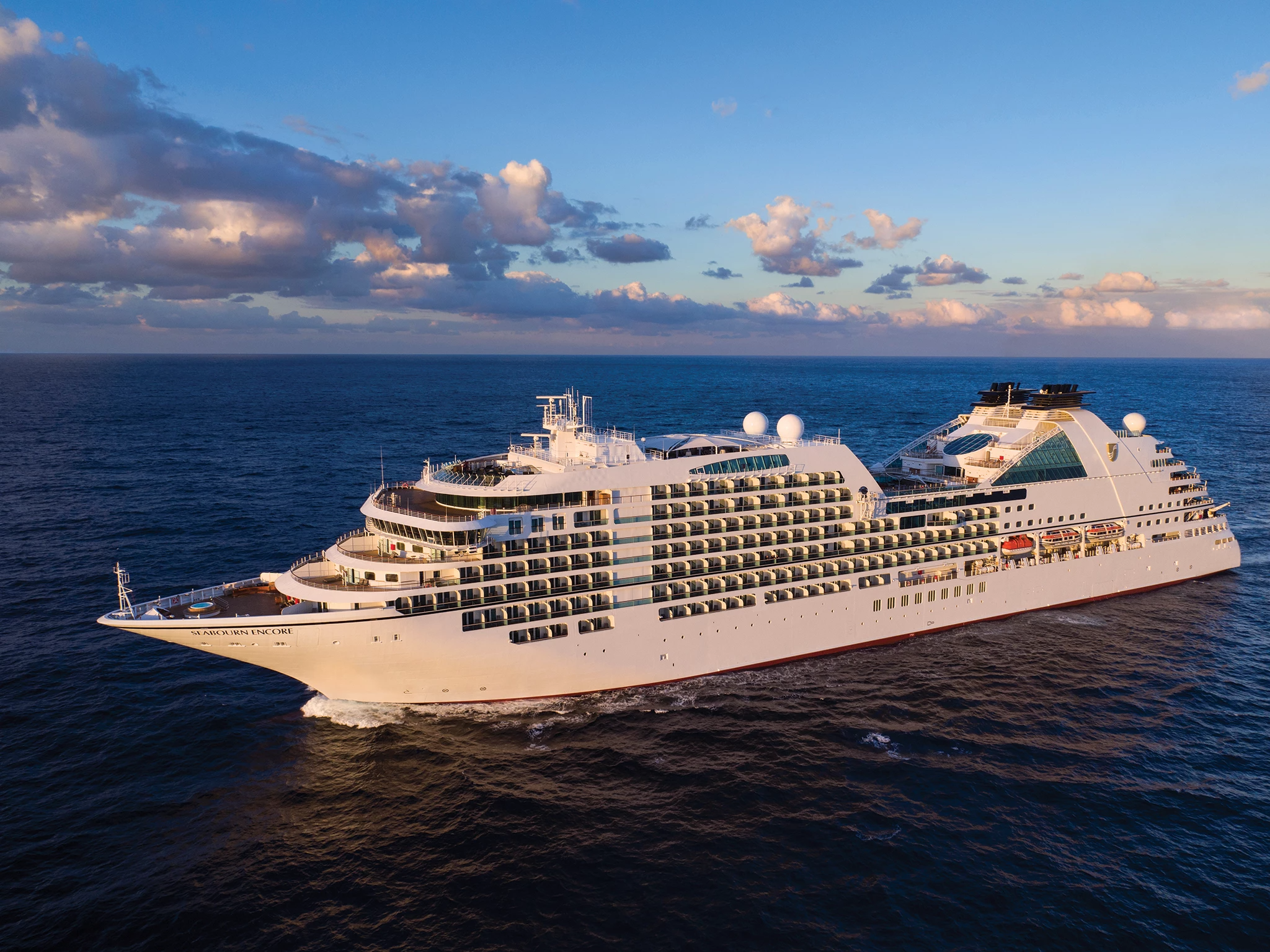
Seabourn Encore is as strikingly beautiful and as excitingly innovative as any Seabourn has ever debuted. She crowns a fleet of luxury cruise ships that is already the newest, most modern and most acclaimed in the ultra-luxury segment. Modeled on the award-winning trio of ships introduced with Seabourn Odyssey, Seabourn Encore represents another welcome stage in the evolution of small ship cruising, which Seabourn pioneered and has consistently expanded and enriched for all of our small ship cruises.
Couples Treatment Room
Spa
Sun Terrace
Swimming Pool
The Retreat
Whirlpool
Bar
Coffee Bar
Restaurant
Sky Bar
Sushi Bar
The Colonnade
Casino
Gaming Club Casino
Photo Gallery
Theatre
Internet Cafe
Conference Room
Elevator
Medical Centre
Shops
Fitness Center
Gym
Wellness Centre
Card Room
Library
Please complete the form below